Loading…
Eedeng Smartpipeline Marking Point Management System
4.0InStock Source-listed auditby Shenzhen EEDENG Technology Co., Ltd
₹83,500≈ $1,000 · indicative, confirm with supplier
Payment
T/T
Incoterms
FOB, EXW
Supplier information
Description
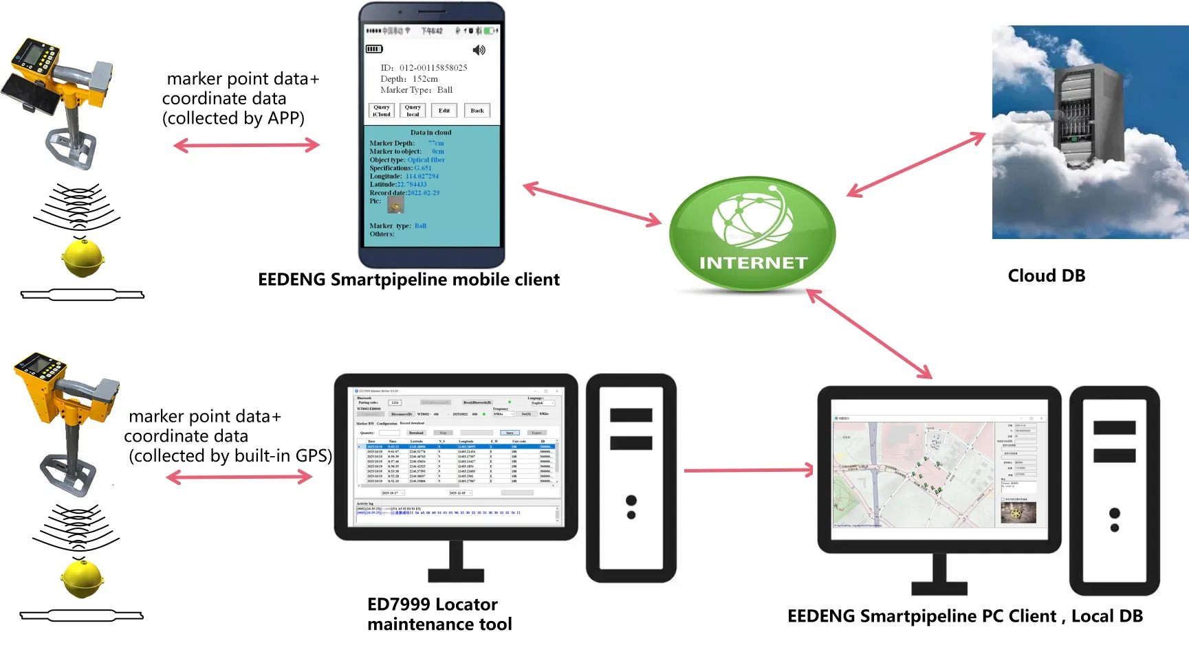
Eedeng Smartpipeline Marking Point Management System. Multi-Platform Input Support: Supports data entry via mobile apps, GPS-enabled electronic locators, and manual methods. Comprehensive Data Tracking: Records ID, coordinates, burial depth, object type, installation time, and pre-backfill photos. Visual Map Integration: Displays marker points as dots on maps and connects them in chronological order. Flexible Storage Options: Data can be stored on cloud servers or local PCs with CSV export capability for GIS exchange. Virtual Identification Support: Enables identification of marker points through electronic markers or virtual points without physical markers. Multi-Language Compatibility: Software supports multiple language versions for global usability. Broad OS Compatibility: Compatible with Windows 98, 2000, 2003, XP, Vista, Win7, and Android mobile OS. Global Market Reach: Serves markets in North America, South America, Europe, Asia, Africa, and Oceania.
Specifications
OSWindows 98,2000,2003,XP,Vista,Win7
TypeProfessional Software
Model NO.EEDENG Smartpipeline
CustomizationAvailable
Language VersionMulti-Language